- Posted on
- • Technology
Digital Remote Sensing
- Author
-
-

- User
- seankerr
- Posts by this author
- Posts by this author
-

It goes without saying that we take a lot of things for granted these days that weren't possible not long ago. I also believe that Canadians don't get enough credit for their tech contributions, so I'd like to take some time to have you consider an early remote sensing company named Dipix Systems Limited- that was based in Ottawa, Canada. They played a big part in developing the computer tech to power digital satellite imagery analysis.
The Dipix name was a combination of Digital+Pixels = Dipix. These two words don't stand out these days- they have become rather pedestrian. But, go back 30 or so years (to 1978) and, these words had a very high tech feeling- and were certainly not commonly used vocabulary back then!
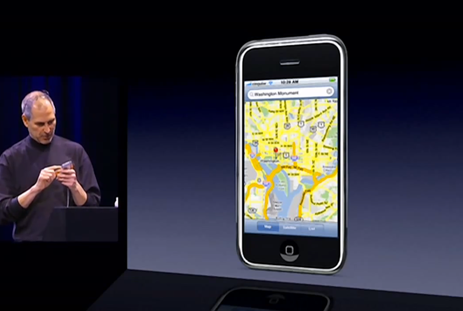
Bear with me while I relate to you a memory that I'll tie in to the topic at hand. I can clearly remember the first time I was able to use an Apple iPhone myself. With its touch sensitive high-res screen, paired with a built in GPS, you could astoundingly zoom in on your current location and see the environment that surrounded you! The ease of manipulating satellite imagery within the palm of your hand, made ordinary or routine by Apple and Google. It quickly gave us the ability to contemplate our immediate environment. This is exactly what GIS and remote sensing aims to do, but on larger scales and over longer timeframes.
Lets take in some perspective on how far we've come. Remote sensing AKA:
the process of detecting and monitoring the physical characteristics of an area by measuring its reflected and emitted radiation at a distance
has been going on for a while. Ariel photography is one example, and then, satellite imagery as well.
Satellites initially used film for photography, where the film payload returned to earth for manual processing. Sometimes the film was processed onboard and transmitted back to Earth. Explorer 6 (1959) transmitted the first satellite image back to Earth without the need to recover physical film.
Once we got good at the process of transmitting images back to earth, there was a lot of image data to deal with. Keep in mind most computers of the era traditionally worked with text input/output, and did not usually manipulate image data of large swaths of land. Computers of the time lacked a mouse, and if they were able to display an image, it would take multiple minutes to display.
The Dipix ARIES III Image Analysis System was designed to manipulate digital data from satellite imagery. ARIES III could discriminate 256 grey levels (reflectance values) from each of the approx. 10 million pixels that made up a single "TM scene" which was 185km x 185km (115 miles). Each TM scene was imaged on 7 different spectral channels, and the ARIES III could work with about 70 million pixels of info. It would enhance the image by applying algorithms to modify the spectral signature of a scene or sub-scene, thus altering the image to reveal features that were obscure on the original image. There were models prior to the Aries III, but I could only find detailed info on this model.
Notably, computer-enhanced images from one study highlighted zones of alteration within a group that had not previously been noted on published maps. The 'alteration zones' appeared to be spatially associated with a number of gold showings and one significant gold deposit. It was concluded that computer manipulation of satellite imagery can add worthwhile information to the geological database of areas that had been mapped at a detailed scale of 1: 10 000.
But the uses of systems developed by Dipix, number more than just the above example of course. Key applications include environmental management, disaster response, resource management, optimizing land use. The topics under these headings are considerable. Helping humans understand the world around them and how it was changing, at much larger scale.
While being considerably important, I feel like this information is antiquated, and so it is easily lost as it is considered something no longer important/relevant today.
I only know about Dipix because my mom worked there for a number of years, and I can fondly remember spending time there while my mom worked over weekends or times when we used computers there to type up grade school reports. I was fascinated seeing the world map with pins showing where their systems were in use. And captivated by the high end commercial systems they had running that I saw from a distance.
I'd like to re-post a snipit from Paul Pearl's (founder of Dipix) LinkedIn:
After a number of years of post-doctoral work in Physics in France and England, saw the light and switched to engineering and industry just prior to coming to Ottawa, Canada in 1974.
In 1978 was bitten by the entrepreneurial bug and founded one of the early remote sensing companies, Dipix Systems Limited. Was to serve as the President of that company through its 9 year existence.
After a period of consulting and long distance sailing, became the President of Dipix Technologies Inc. in 1992 where he successfully redirected the company away from remote sensing into the more lucrative field of machine vision. Dipix was acquired by the Tarquin Group in 2007.
Also borrowed from Paul's LinkedIn page, some details on Dipix:
Dipix Systems Ltd (1978-1987) was one of the earliest commercial companies targeted at providing computer based analysis equipment for handling space-borne and airborne image data. In the mid-80s it was the largest Canadian high technology company selling into the Chinese market place and had sales of around $10 million with over 80 employees worldwide.
For future posterity, I will also re-post some ARIES system specs here. The info is from a paper: "LIS/GIS Products and Issues: A Manufacturers' Forum", which was published in Feb of 1988 by asprs (the imaging & geospatial information society):
Dipix Systems Limited 120 Colonnade Road, Ottawa, Ontario K2E 7J5, Canada
The Dipix stand-alone MicroARIES workstation is a new, lowcost, entry level system for image analysis. The MicroARIES combines VAX/VMS versatility and unique ARIES display architecture in a compact, powerful workstation. Baseline components include an ARIES-III Plus image display subsystem with expandable image memory; a 512 color display monitor with interactive tablet and mouse; a 3 MB dedicated VAXstation II CPU with a 95 MB cartridge tape, a 71 MB disk drive and 19-inch graphics terminal with keyboard and mouse; a standard Ethernet interface; and MicroARIES operating and applications software modules and full compatibility with additional ARIES applications software products.
The baseline MicroARIES workstation can be expanded to meet user requirements. The display subsystem can be enhanced with a 19-inch, 60 Hz, non-interlaced 1024 monitor with multi-image window handling. An ARIES Pixel Processor can be added to the display to dramatically increase interactive processing power. Large 268 or 677 MB disk drives and 1600/ 6250 BPI tape drives are available for large storage and input requirements. A wide range of ARIES integrated imaging peripherals - color film recorders, photodigitizers,. frame grabbers, digitizing tables, and ink jet plotters - are also fully supported on the MicroARIES.
The MicroARIES display architecture with its unique image memory allows random access to both very large images (16K by 16K or larger) and multiple image data sets. Up to 63 images of varying rectangular dimensions and pixel depths can be stored in image memory. Spatial resolution and pixel depth can be adjusted for maximum memory utilization.
With the 1024 option on the MicroARIES, six display topologies can be selected directly from the tablet. Ten images can be viewed simultaneously in independent display windows. The windows can be of any rectangular shape. Windows can be moved, enlarged, reduced, or overlaid interactively using the tablet and mouse. Multiple, independent display windows provide efficient desktop flexibility for analyzing complex image data. To further enhance MicroARIES functionality and processing power, an ARIES Pixel Processor (APP) can be integrated into the display subsystem. the APP provides interactive geometric resampling, spatial filtering, expansive/compressive zoom, and image rotation. All functions are controlled with the tablet and mouse. This interactive power and high speed processing makes the MicroARIES with an APP. an ideal workstation for both research and production environments.
The ARIES baseline operating system and the Level 1 applications software package are both included with the MicroARIES. This Level 1 package provides data input, display manipulation, and general image processing functions. All ARIES VMS applications software is compatible with the workstation. Advanced remote sensing, GIS, vector, mosaicking, map output, and other packages are currently supported as MicroARIES options. Programming libraries are also available for user-specific software development. The MicroARIES is the entry point into the expanding world of ARIES-III Plus integrated imaging systems. With full ARIES product compatibility, MicroARIES offers a wide range of configurations to meet current requirements and expanding functionality to meet future needs. The MicroARIES is a single-user system with a 3 or 5 MB CPU embedded into the VAXstation II.
The 95 MB cartridge tape, 71 MB internal disks, and optional disk drives provide excellent storage capability for handling large image data sets. The large 19-inch graphics terminal with keyboard and mouse includes a standard windowing function. The user can easily display large amounts of information and view multiple tasks executing concurrently.
The workstation MicroVMS operating system provides fast response time, multi-tasking and excellent networking capability. The standard Ethernet connection or optional DECnet provides networking capabilities for compatible multi-user environments.
Surely the ARIES systems were on another level and designed to do different things from the first Apple Maps on iPhone. But, it is fun to roughly compare the devices when looking for perspective on how far we've come.